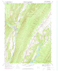
1967 Map of Hyndman
USGS Topo · Published 1973About this map
Hyndman serves as the central hub of this topographical study, positioned where the Baltimore and Ohio and Penn Central rail lines converge along the narrow valley floor. The geography is defined by the steep parallel ridges of Coughenour Ridge and Wills Mountain, which funnel Wills Creek and its tributaries through the landscape. To the southeast, the terrain opens into the Cumberland Valley, where the waters of Evitts Creek are captured by Lake Koon and Lake Gordon. Small settlements such as Fossilville and Centerville dot the lower elevations, while large tracts of State Game Lands No 48 and State Game Lands No 104 cover the high ground. The presence of rural landmarks like Bortz Ch and the High Sch in Hyndman provides a detailed look at the social infrastructure of Bedford County during the late 1960s.
Find a feature on this map
44 named features on this map. Tap any name to fly to it.
Don’t see what you’re looking for? This feature index may not catch every label — zoom into the map to look around manually.
Map Details
Editions of this 1967 Hyndman Map
Other maps of this area

1898 · Frostburg
USGS Topo · 1:62,500

1899 · Flintstone
USGS Topo · 1:62,500

1900 · Flintstone
USGS Topo · 1:62,500

1901 · Frostburg
USGS Topo · 1:62,500

1908 · Frostburg
USGS Topo · 1:62,500

1923 · Berlin
USGS Topo · 1:48,000

1927 · Hyndman
USGS Topo · 1:62,500

1929 · Berlin
USGS Topo · 1:62,500

1931 · Hyndman
USGS Topo · 1:62,500

1944 · Hyndman
USGS Topo · 1:62,500
Featured Places
- Hyndman, PA
- Cumberland Valley Township, PA
- Harrison Township, PA
- Southampton Township, PA
- Londonderry Township, PA