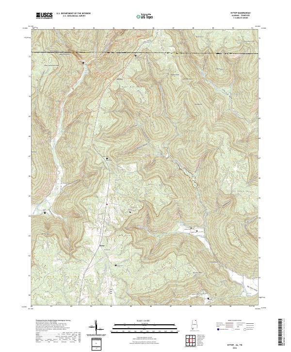
2024 Map of Hytop
USGS Topo · Published 2024About this map
The settlement of Hytop sits atop the dissected Cumberland Plateau, marking a landscape where Alabama meets Tennessee at the northern edge of Jackson County. This high-elevation terrain is defined by deep drainage systems like Big Coon Creek and Hurricane Creek, which have carved out dramatic features such as the Walls of Jericho and various coves like Hicks Cove and Tate Cove. The map reveals a dispersed rural pattern of family legacy, evident in the numerous small burial grounds including Hytop Cem, Matthews Cem, and Knight Cem.
Find a feature on this map
97 named features on this map. Tap any name to fly to it.
Don’t see what you’re looking for? This feature index may not catch every label — zoom into the map to look around manually.
Map Details
Editions of this 2024 Hytop Map
This is the sole edition of this map. No revisions or reprints were ever made.
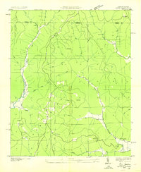
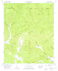
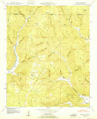
Historical Maps of Jericho Through Time
4 maps found