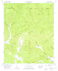
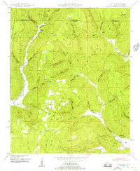
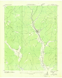
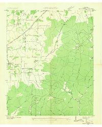
1948 Map of Hytop
USGS Topo · Published 1976About this map
Hytop sits atop the southern reaches of the Cumberland Plateau in Jackson County, where the high tableland begins its descent into the complex cove and valley systems of northern Alabama. This mid-century survey captures a landscape defined by sharp elevation changes between the plateau summit and the deep basins of Billy Cove and Tate Cove. The settlement pattern follows the drainage networks and accessible gaps, with several family and community burial grounds such as Clark Cem, Hytop Cem, and Knight Cem marking established local heritage sites. Water sources like Polly Anne Spring and Tate Spring appear as vital points in the upland terrain. The map also delineates the state boundary where the plateau crosses from Franklin County in Tennessee into Alabama, illustrating how the topography of Little Coon Mountain and Little Cumberland Mountain dictated early regional transit and land use.
Find a feature on this map
72 named features on this map. Tap any name to fly to it.
Don’t see what you’re looking for? This feature index may not catch every label — zoom into the map to look around manually.
Map Details
Editions of this 1948 Hytop Map
2 editions found
Other maps of this area

1886 · Stevenson
USGS Topo · 1:125,000

1888 · Scottsboro
USGS Topo · 1:125,000

1892 · Scottsboro
USGS Topo · 1:125,000

1892 · Stevenson
USGS Topo · 1:125,000

1895 · Stevenson
USGS Topo · 1:125,000

1895 · Sewanee
USGS Topo · 1:125,000

1928 · Decherd
USGS Topo · 1:62,500

1936 · Wannville
USGS Topo · 1:24,000
1936 · Sinking Cove
USGS Topo · 1:24,000
1936 · Beans Creek
USGS Topo · 1:24,000