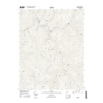
2014 Map of Iaeger
USGS Topo · Published 2014About this map
The town of Iaeger serves as the focal point for this survey of the Tug Fork river valley, where the confluence with the Dry Fork and Johnnycake Br dictates the settlement pattern. This area of McDowell County is characterized by winding river roads and deep hollows like Sal Gibson Hollow and Trail Holw, with numerous small communities such as Litwar, Avondale, and Beartown following the narrow valley floors. The landscape is dotted with family-named landmarks and cemeteries, including Lockhart Cem, Collins Cem, and Meadows Cem, providing valuable data for genealogical research. Notable infrastructure includes the D C Perry Memorial Bridge and the Lt Sara Blanche Vance Bridge, which facilitate travel through this complex terrain. High elevations like High Knob and Pine Knob overlook the interconnected branches and ridges, illustrating the industrial and residential development constrained by the geography of the coalfields.
Find a feature on this map
106 named features on this map. Tap any name to fly to it.
Don’t see what you’re looking for? This feature index may not catch every label — zoom into the map to look around manually.
Map Details
Editions of this 2014 Iaeger Map
This is the sole edition of this map. No revisions or reprints were ever made.
Other maps of this area

1891 · Tazewell
USGS Topo · 1:125,000

1891 · Oceana
USGS Topo · 1:125,000

1893 · Oceana
USGS Topo · 1:125,000

1895 · Tazewell
USGS Topo · 1:125,000

1897 · Tazewell
USGS Topo · 1:125,000

1898 · Oceana
USGS Topo · 1:125,000

1909 · Gilbert
USGS Topo · 1:48,000

1910 · Pineville
USGS Topo · 1:48,000

1910 · Iaeger
USGS Topo · 1:48,000

1912 · Gilbert
USGS Topo · 1:62,500