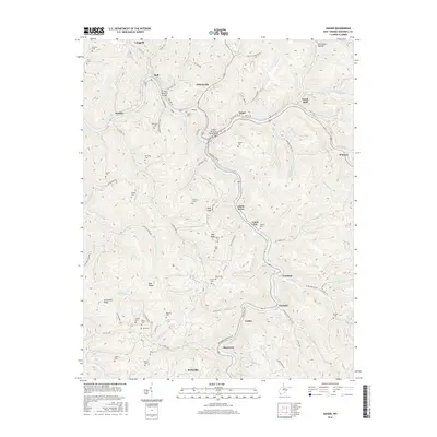
2016 Map of Iaeger
USGS Topo · Published 2016About this map
The Tug Fork river system defines the settlement patterns of this McDowell County landscape, where communities like Iaeger and Avondale occupy the narrow valley floors. Transportation infrastructure is central to the area's history, evidenced by the D.C. Perry Memorial Bridge and the Lt Sara Blanche Vance Bridge crossing the water. The rugged geography of Bee Ridge and Sourwood Ridge forced development into tightly clustered pockets such as Carlos Bottom and Beartown. Local genealogists will find numerous family burial grounds scattered across the heights, including Pine Collins Cem, Bowles Cem, and Kelly Cem. The presence of Railroad Yard Rd near Iaeger points to the area's long-standing connection to the regional rail economy that historically moved resources through these steep West Virginia hollows.
Find a feature on this map
106 named features on this map. Tap any name to fly to it.
Don’t see what you’re looking for? This feature index may not catch every label — zoom into the map to look around manually.
Map Details
Editions of this 2016 Iaeger Map
This is the sole edition of this map. No revisions or reprints were ever made.
Other maps of this area

1891 · Tazewell
USGS Topo · 1:125,000

1891 · Oceana
USGS Topo · 1:125,000

1893 · Oceana
USGS Topo · 1:125,000

1895 · Tazewell
USGS Topo · 1:125,000

1897 · Tazewell
USGS Topo · 1:125,000

1898 · Oceana
USGS Topo · 1:125,000

1909 · Gilbert
USGS Topo · 1:48,000

1910 · Pineville
USGS Topo · 1:48,000

1910 · Iaeger
USGS Topo · 1:48,000

1912 · Gilbert
USGS Topo · 1:62,500