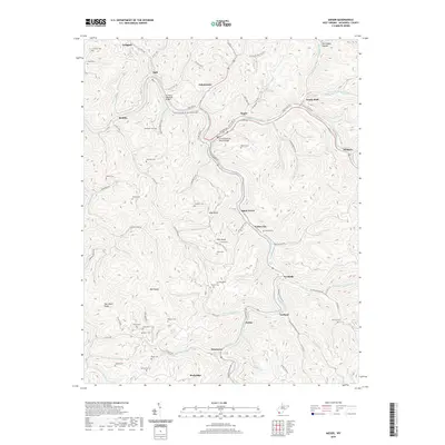
2019 Map of Iaeger
USGS Topo · Published 2019About this map
Iaeger sits at the confluence of the Tug Fork and Dry Fork, serving as a central hub for the transport networks of McDowell County. The rail infrastructure is prominent, with Railroad Ave and the Railroad Yard Rd supporting the industrial movement of goods through the Appalachian ridges. Modern connections are solidified by the Lt Sara Blanche Vance Bridge and the D C Perry Memorial Bridge, which span the river valleys. The landscape is characterized by its steep-walled hollows and ridges, such as Bee Ridge and Sourwood Ridge, where family histories are preserved in numerous small burial grounds including the Meadows Cem, Steele Cem, and Kennedy Cem. Moving south into the hills, smaller communities like Carlos and Beartown are linked by winding routes like Garland-Betsy Branch Rd, illustrating the persistence of these narrow valley settlements.
Find a feature on this map
109 named features on this map. Tap any name to fly to it.
Don’t see what you’re looking for? This feature index may not catch every label — zoom into the map to look around manually.
Map Details
Editions of this 2019 Iaeger Map
This is the sole edition of this map. No revisions or reprints were ever made.
Other maps of this area

1891 · Tazewell
USGS Topo · 1:125,000

1891 · Oceana
USGS Topo · 1:125,000

1893 · Oceana
USGS Topo · 1:125,000

1895 · Tazewell
USGS Topo · 1:125,000

1897 · Tazewell
USGS Topo · 1:125,000

1898 · Oceana
USGS Topo · 1:125,000

1909 · Gilbert
USGS Topo · 1:48,000

1910 · Pineville
USGS Topo · 1:48,000

1910 · Iaeger
USGS Topo · 1:48,000

1912 · Gilbert
USGS Topo · 1:62,500