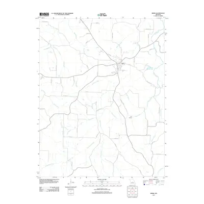
2011 Map of Iberia
USGS Topo · Published 2011About this map
Iberia serves as the central hub of this Missouri landscape, where the street grid converges at the intersection of Main St and S High St. The surrounding countryside is defined by a dense network of waterways, most notably Tavern Creek and its various tributaries like Rabbithead Creek and Whittle Creek. To the west, Boiling Springs and Blue Spring highlight the area's karst topography and natural water sources, while Groffs Retreat Lake offers a prominent point of interest to the east. The road network reflects the local history and economy through names like Charcoal Kiln Rd and several river crossings including Madden Ford Rd and Watkins Ford Rd. This 2011 survey captures the enduring rural character of Miller County, preserving the locations of family-named landmarks and local sites such as Fox Hollow.
Find a feature on this map
59 named features on this map. Tap any name to fly to it.
Don’t see what you’re looking for? This feature index may not catch every label — zoom into the map to look around manually.
Map Details
Editions of this 2011 Iberia Map
This is the sole edition of this map. No revisions or reprints were ever made.
Other maps of this area

1888 · Tuscumbia
USGS Topo · 1:125,000

1894 · Tuscumbia
USGS Topo · 1:125,000

1933 · Iberia
USGS Topo · 1:62,500

1936 · Waynesville
USGS Topo · 1:48,000

1937 · Iberia
USGS Topo · 1:62,500

1942 · Waynesville
USGS Topo · 1:62,500

1943 · Richland
USGS Topo · 1:62,500

1944 · Waynesville
USGS Topo · 1:62,500

1947 · Jefferson City
USGS Topo · 1:250,000

1948 · Tavern
USGS Topo · 1:62,500