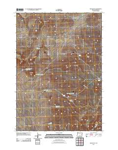
2011 Map of Ibex Butte
USGS Topo · Published 2011About this map
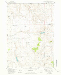
Ibex Butte and Willow Butte rise above a landscape defined by critical water management in this arid stretch of Crook County. The 2011 survey reveals a complex network of artificial catchments, most notably the Twelvemile Reservoir Number One through Number Four series, which underscores the region's reliance on gathered surface water for ranching or local ecosystems. These reservoirs are complemented by natural features such as Rickman Spring and Juniper Spring, as well as utilitarian sites like Santry Waterhole and Ibex Waterhole. Transport is marked by a series of local roads and trails that navigate between prominent elevations like Ann Butte and Kid Peak. The presence of Buck Creek in the southeast corner and The Cove in the north suggests a varied topography where drainage patterns and distinct landforms have dictated the placement of these vital water resources.
Find a feature on this map
18 named features on this map. Tap any name to fly to it.
Don’t see what you’re looking for? This feature index may not catch every label — zoom into the map to look around manually.
Map Details
Editions of this 2011 Ibex Butte Map
This is the sole edition of this map. No revisions or reprints were ever made.
Other maps of this area

1955 · Crescent
USGS Topo · 1:250,000

1955 · Burns
USGS Topo · 1:250,000

1957 · Crescent
USGS Topo · 1:250,000

1958 · Crescent
USGS Topo · 1:250,000

1958 · Burns
USGS Topo · 1:250,000

1959 · Burns
USGS Topo · 1:250,000
1970 · Crescent
USGS Topo · 1:250,000
1981 · Mackey Butte
USGS Topo · 1:24,000
1981 · Hardin Ranch
USGS Topo · 1:24,000
1981 · Twelvemile Reservoir
USGS Topo · 1:24,000