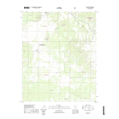
2020 Map of Ice Caves
USGS Topo · Published 2020About this map
Ice Caves and the volcanic landscape of the Zuni-Bandera volcanic field define this section of the High Desert. The topography is dominated by numerous cinder cones and craters, including Bandera Crater, Cerro Bandera, and the appropriately named Lava Crater. This era of the landscape is protected within the El Malpais National Monument and the Cibola National Forest, showing a network of modern recreational and historical routes. The Continental Divide National Scenic Trail winds through the northern sections, passing near Laguna Juan Garcia, while specialized local paths like the El Calderon Loop and the Pack Trail provide access to features such as the Big Tubes. The map illustrates the complex intersection of geological formations and federal land management in western New Mexico.
Find a feature on this map
24 named features on this map. Tap any name to fly to it.
Don’t see what you’re looking for? This feature index may not catch every label — zoom into the map to look around manually.
Map Details
Editions of this 2020 Ice Caves Map
This is the sole edition of this map. No revisions or reprints were ever made.
Other maps of this area

1883 · Mt. Taylor
USGS Topo · 1:250,000

1886 · Wingate
USGS Topo · 1:250,000

1886 · Mt. Taylor
USGS Topo · 1:250,000

1892 · Wingate
USGS Topo · 1:250,000

1892 · Mt. Taylor
USGS Topo · 1:250,000

1899 · Mt. Taylor
USGS Topo · 1:250,000

1917 · Broom Mountain
USGS Topo · 1:125,000

1952 · Valle Largo
USGS Topo · 1:24,000

1952 · Paxton Springs
USGS Topo · 1:24,000

1954 · Saint Johns
USGS Topo · 1:250,000