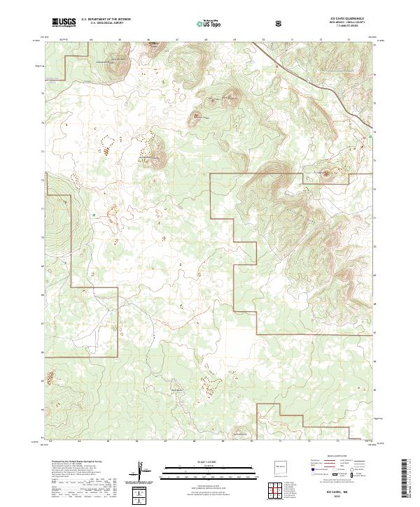
2023 Map of Ice Caves
USGS Topo · Published 2023About this map
Bandera Crater and the volcanic terrain of the Cibola National Forest dominate this high-desert landscape in New Mexico. The area is defined by its namesake geological formations, where ancient lava flows and cinder cones like Lava Crater, Lost Woman Crater, and Twin Craters provide a stark look at the region's geothermal history. These features are accessible via the Continental Divide National Scenic Trl, which winds north past Cerro Bandera and south through the heart of the malpais. The southern reaches of the map include the West Malpais Wilderness, a protected area of volcanic rock and sparse vegetation. Hikers and researchers can trace the El Calderon Loop Trl or follow the Pack Trl across open flats like Mesita Blanca, while the presence of Laguna Juan Garcia in the northwest corner highlights the few water sources found in this arid expanse.
Find a feature on this map
24 named features on this map. Tap any name to fly to it.
Don’t see what you’re looking for? This feature index may not catch every label — zoom into the map to look around manually.
Map Details
Editions of this 2023 Ice Caves Map
This is the sole edition of this map. No revisions or reprints were ever made.
Other maps of this area

1883 · Mt. Taylor
USGS Topo · 1:250,000

1886 · Wingate
USGS Topo · 1:250,000

1886 · Mt. Taylor
USGS Topo · 1:250,000

1892 · Wingate
USGS Topo · 1:250,000

1892 · Mt. Taylor
USGS Topo · 1:250,000

1899 · Mt. Taylor
USGS Topo · 1:250,000

1917 · Broom Mountain
USGS Topo · 1:125,000

1952 · Valle Largo
USGS Topo · 1:24,000

1952 · Paxton Springs
USGS Topo · 1:24,000

1954 · Saint Johns
USGS Topo · 1:250,000