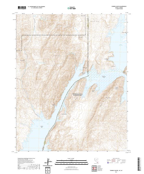
2021 Map of Iceberg Canyon
USGS Topo · Published 2021About this map
The dramatic meeting of Nevada and Arizona is defined here by the waters of Lake Mead and the winding course of Iceberg Canyon. Within the Lake Mead National Recreation Area, the landscape is a complex network of inundated canyons and high desert ridges. Water features such as Grand Wash Bay and Grand Wash Canyon dominate the eastern portion, while the western side transitions into the Mojave Desert and the broken terrain of Hells Kitchen. Significant topographic markers like Iceberg Ridge and Wheeler Ridge frame the waterway, leading toward landmarks like Iceberg Reef and Iceberg Rapid. This area represents a critical intersection of hydrological management and desert wilderness, where seasonal flows from Connoly Wash and Indian Hills Wash meet the permanent reservoir. From the heights of the Million Hills to the secluded coves like Crappie Cove and Sunfish Cove, the map illustrates the intricate shoreline of this desert oasis.
Find a feature on this map
55 named features on this map. Tap any name to fly to it.
Don’t see what you’re looking for? This feature index may not catch every label — zoom into the map to look around manually.
Map Details
Editions of this 2021 Iceberg Canyon Map
This is the sole edition of this map. No revisions or reprints were ever made.
Other maps of this area

1886 · Saint Thomas
USGS Topo · 1:250,000

1886 · Mt. Trumbull
USGS Topo · 1:250,000

1892 · Mt. Trumbull
USGS Topo · 1:250,000

1893 · Saint Thomas
USGS Topo · 1:250,000

1926 · Bonelli
USGS Topo · 1:96,000

1953 · Iceberg Canyon
USGS Topo · 1:62,500

1953 · Gold Butte
USGS Topo · 1:62,500

1953 · Grand Canyon
USGS Topo · 1:250,000

1954 · Las Vegas
USGS Topo · 1:250,000

1957 · Las Vegas
USGS Topo · 1:250,000