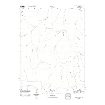
2010 Map of Icehouse Canyon
USGS Topo · Published 2010About this map
Clardy Ranch stands as a lonely human outpost in this high desert landscape of Las Animas County, where the terrain is defined by a dense network of erosional drainages. The map reveals a complex system of seasonal watercourses and ridges, including the prominent Piñon Canyon and its tributaries like Icehouse Canyon and Turkey Spring Canyon. This geography influenced the movement and settlement of the region, as seen in the placement of County Rd 54.0 and County Rd 193.5, which navigate the high ground between deep cuts such as West Maverick Canyon and Smith Canyon. Toward the southern edge, Creek 54 and Cedar Pen Canyon show the natural progression of the watershed as it descends through this arid environment. The presence of named features like Tafoya Canyon and Yeiser Canyon suggests the enduring legacy of early families and land use in this part of Colorado.
Find a feature on this map
22 named features on this map. Tap any name to fly to it.
Don’t see what you’re looking for? This feature index may not catch every label — zoom into the map to look around manually.
Map Details
Editions of this 2010 Icehouse Canyon Map
This is the sole edition of this map. No revisions or reprints were ever made.
Other maps of this area

1891 · Higbee
USGS Topo · 1:125,000

1891 · Timpas
USGS Topo · 1:125,000

1891 · Mesa De Maya
USGS Topo · 1:125,000

1892 · Mt Carrizo
USGS Topo · 1:125,000

1893 · Higbee
USGS Topo · 1:125,000

1893 · Mesa de Maya
USGS Topo · 1:125,000

1894 · Timpas
USGS Topo · 1:125,000

1955 · La Junta
USGS Topo · 1:250,000

1958 · La Junta
USGS Topo · 1:250,000

1968 · La Junta
USGS Topo · 1:250,000