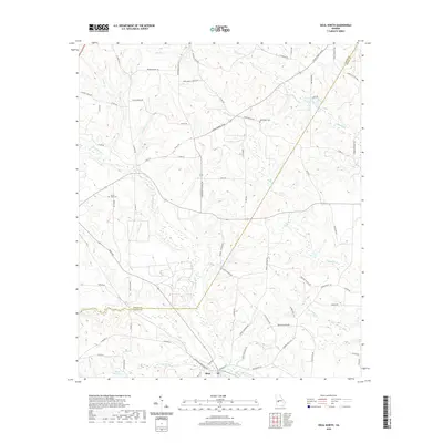
2020 Map of Ideal North
USGS Topo · Published 2020About this map
The town of Ideal sits at the southern edge of this landscape, positioned where the terrain begins to slope toward the substantial waters of Whitewater Creek. This agricultural region on the border of Taylor and Macon counties is defined by a complex network of small drainage systems, including Meadow Cr, Toteover Cr, and Cedar Cr. The map reveals a rural infrastructure of named farm roads and small landmarks that suggest a long-established local community, such as Brooks Mill Pond and Mount Sinai Cem.
Find a feature on this map
69 named features on this map. Tap any name to fly to it.
Don’t see what you’re looking for? This feature index may not catch every label — zoom into the map to look around manually.
Map Details
Editions of this 2020 Ideal North Map
This is the sole edition of this map. No revisions or reprints were ever made.
Other maps of this area

1955 · Phenix City
USGS Topo · 1:250,000

1957 · Phenix City
USGS Topo · 1:250,000

1958 · Phenix City
USGS Topo · 1:250,000

1971 · Rupert
USGS Topo · 1:24,000

1971 · Ideal South
USGS Topo · 1:24,000

1971 · Reynolds
USGS Topo · 1:24,000

1971 · Ideal North
USGS Topo · 1:24,000

1971 · Ellaville North
USGS Topo · 1:24,000

1971 · Garden Valley
USGS Topo · 1:24,000
1971 · Butler West
USGS Topo · 1:24,000