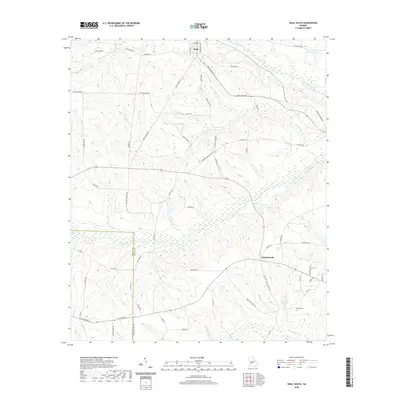
2020 Map of Ideal South
USGS Topo · Published 2020About this map
Ideal and Fountainville serve as the primary local hubs for this portion of southern Georgia, where the Schley Co Macon Co line follows a prominent ridge. The landscape is defined by the significant drainage networks of Buck Creek and Whitewater Creek, which carve winding paths through the terrain. Evidence of early rural infrastructure and family landholdings is visible through features like the English Millpond and English Cem, indicating a history tied to local water power and family legacy. The road network, including the specifically named Travelers Home Church Rd and Taylor Cemetery Rd, suggests a community structure built around established religious and commemorative sites. Further to the north, Kennedy Lake and Sand Creek provide additional water landmarks within this agricultural and woodland setting.
Find a feature on this map
63 named features on this map. Tap any name to fly to it.
Don’t see what you’re looking for? This feature index may not catch every label — zoom into the map to look around manually.
Map Details
Editions of this 2020 Ideal South Map
This is the sole edition of this map. No revisions or reprints were ever made.
Other maps of this area

1955 · Phenix City
USGS Topo · 1:250,000

1957 · Phenix City
USGS Topo · 1:250,000

1958 · Phenix City
USGS Topo · 1:250,000

1971 · Rupert
USGS Topo · 1:24,000

1971 · Ideal South
USGS Topo · 1:24,000

1971 · Ideal North
USGS Topo · 1:24,000

1971 · Ellaville North
USGS Topo · 1:24,000

1971 · Garden Valley
USGS Topo · 1:24,000

1971 · Montezuma
USGS Topo · 1:24,000

1972 · Ellaville South
USGS Topo · 1:24,000