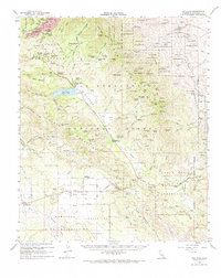
1959 Map of Idyllwild
USGS Topo · Published 1967About this map
Idyllwild serves as the focal point for this late-1950s study of the San Jacinto Mountains, appearing alongside high-altitude settlements like Saunders Meadow and Mountain Center. The landscape is a complex patchwork of public and tribal lands, including segments of the San Bernardino National Forest and three distinct tribal areas: the Agua Caliente Indian Reservation, Cahuilla Indian Reservation, and Santa Rosa Indian Reservation. Cultural development is concentrated along the valleys, with the Desert Sun Sch near Tahquitz Peak and the Hamilton Sch in the Anza Valley.
Find a feature on this map
123 named features on this map. Tap any name to fly to it.
Don’t see what you’re looking for? This feature index may not catch every label — zoom into the map to look around manually.
Map Details
Editions of this 1959 Idyllwild Map
3 editions found
Other maps of this area

1901 · Southern California Sheet No. 1
USGS Topo · 1:250,000

1901 · San Jacinto
USGS Topo · 1:125,000

1903 · Ramona
USGS Topo · 1:125,000

1904 · Indio
USGS Topo · 1:125,000

1904 · Southern California Sheet No. 2
USGS Topo · 1:250,000

1904 · Southern California Sheet No. 1
USGS Topo · 1:250,000

1931 · Vallecito
USGS Topo · 1:125,000

1939 · Warner Springs
USGS Topo · 1:62,500

1939 · Palomar Mountain
USGS Topo · 1:62,500

1940 · Palm Springs
USGS Topo · 1:62,500
Featured Places
- Palm Springs, CA
- Idyllwild, Idyllwild-Pine Cove
- Mountain Center, CA
- Idyllwild-Pine Cove, CA
- New Santa Rosa, CA