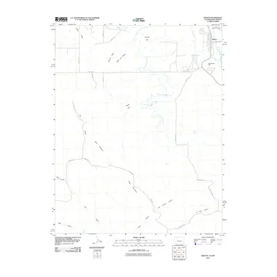
2010 Map of Ignacio
USGS Topo · Published 2010About this map
Ignacio serves as the primary settlement on this 2010 topographic survey, situated near the banks of the Los Pinos River. The landscape is defined by the high elevations of the Mesa Mountains and a series of prominent landforms including Olson Ridge, Worford Ridge, and Black Joe Ridge. This modern mapping reflects a rural infrastructure heavily reliant on water management, evidenced by the Morrison Consolidated Ditch and the Pine River Southwest Ditch winding through the terrain.
Find a feature on this map
31 named features on this map. Tap any name to fly to it.
Don’t see what you’re looking for? This feature index may not catch every label — zoom into the map to look around manually.
Map Details
Editions of this 2010 Ignacio Map
This is the sole edition of this map. No revisions or reprints were ever made.
Other maps of this area

1889 · Largo
USGS Topo · 1:250,000

1895 · Largo
USGS Topo · 1:250,000

1908 · Ignacio
USGS Topo · 1:125,000

1924 · Ignacio
USGS Topo · 1:125,000

1945 · Durango
USGS Topo · 1:250,000

1953 · Durango
USGS Topo · 1:250,000

1954 · Durango
USGS Topo · 1:250,000
1954 · Burnt Mesa
USGS Topo · 1:24,000

1954 · Aztec
USGS Topo · 1:250,000

1958 · Aztec
USGS Topo · 1:250,000