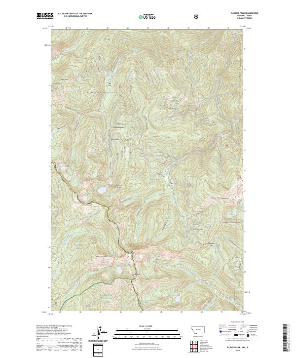
2024 Map of Illinois Peak
USGS Topo · Published 2024About this map
The Bitterroot Mountains straddle the Idaho-Montana border in this 2024 survey, highlighting the divide between Lolo National Forest and St Joe National Forest. This high-altitude landscape is characterized by a series of prominent summits including Illinois Peak, Gold Crown Peak, and Graves Peak, which define the rugged boundary of Shoshone and Mineral counties. The drainage patterns show waters flowing from sources like Saint Joe Lake and Missoula Lake into a complex network of gulches.
Find a feature on this map
68 named features on this map. Tap any name to fly to it.
Don’t see what you’re looking for? This feature index may not catch every label — zoom into the map to look around manually.
Map Details
Editions of this 2024 Illinois Peak Map
This is the sole edition of this map. No revisions or reprints were ever made.
Other maps of this area

1911 · Lolo
USGS Topo · 1:250,000

1913 · Lolo
USGS Topo · 1:250,000

1918 · St Regis
USGS Topo · 1:125,000

1919 · St. Regis
USGS Topo · 1:125,000

1956 · Wallace
USGS Topo · 1:250,000

1956 · Hamilton
USGS Topo · 1:250,000

1957 · Illinois Peak
USGS Topo · 1:62,500

1959 · Hamilton
USGS Topo · 1:250,000

1960 · Wallace
USGS Topo · 1:250,000

1960 · Hamilton
USGS Topo · 1:250,000