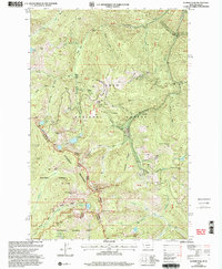
1999 Map of Illinois Peak
USGS Topo · Published 2003About this map
Illinois Peak stands at the center of this high-elevation terrain along the Montana-Idaho state line, where the Bitterroot Mountains divide the Lolo National Forest, St Joe National Forest, and Clearwater National Forest. The landscape is a network of named gulches and high peaks that reflect a history of hard-rock prospecting. The map records several named operations such as the Silver King Mine, American Gold Mine, and the Superior Mine with its associated tailings. The presence of La Casse Camp and numerous adits suggests a localized mining economy integrated into the drainage systems of Oregon Creek and the North Fork Trout Creek. Travel through this backcountry at the end of the millennium was facilitated by established routes like the Superior Red Ives Ranger Trail, connecting remote drainage basins across high saddles like Miller Saddle.
Find a feature on this map
65 named features on this map. Tap any name to fly to it.
Don’t see what you’re looking for? This feature index may not catch every label — zoom into the map to look around manually.
Map Details
Editions of this 1999 Illinois Peak Map
This is the sole edition of this map. No revisions or reprints were ever made.
Other maps of this area

1911 · Lolo
USGS Topo · 1:250,000

1913 · Lolo
USGS Topo · 1:250,000

1918 · St Regis
USGS Topo · 1:125,000

1919 · St. Regis
USGS Topo · 1:125,000

1956 · Wallace
USGS Topo · 1:250,000

1956 · Hamilton
USGS Topo · 1:250,000

1957 · Illinois Peak
USGS Topo · 1:62,500

1959 · Hamilton
USGS Topo · 1:250,000

1960 · Wallace
USGS Topo · 1:250,000

1960 · Hamilton
USGS Topo · 1:250,000