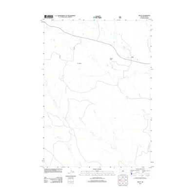
2012 Map of Imlay
USGS Topo · Published 2012About this map
Hunt Table and Keester Table define the elevated geography of this South Dakota landscape, where high plateaus overlook a network of seasonal drainages. The small settlement of Imlay is positioned along a primary road corridor in the northeastern portion of the sheet, serving as a focal point in a largely open ranching or conservation environment. The terrain is deeply etched by numerous creek beds, including Cain Cr, Big Hollow Cr, and Wind Cr, which illustrate the complex erosion patterns characteristic of the region. These watercourses, along with Clifford Cr, indicate the drainage system that supports the local ecology and livestock. The map provides a detailed view of the infrastructure and landforms before more modern developments might have altered these remote stretches of Pennington County.
Find a feature on this map
9 named features on this map. Tap any name to fly to it.
Don’t see what you’re looking for? This feature index may not catch every label — zoom into the map to look around manually.
Map Details
Editions of this 2012 Imlay Map
This is the sole edition of this map. No revisions or reprints were ever made.
Other maps of this area

1950 · Sheep Mountain Table
USGS Topo · 1:24,000

1950 · Stirk Table
USGS Topo · 1:24,000

1950 · Imlay SW
USGS Topo · 1:24,000

1950 · Imlay
USGS Topo · 1:24,000

1950 · Imlay SE
USGS Topo · 1:24,000

1950 · Bouquet Table
USGS Topo · 1:24,000

1952 · Bouquet Table
USGS Topo · 1:24,000

1954 · Scenic
USGS Topo · 1:24,000

1955 · Hot Springs
USGS Topo · 1:250,000

1960 · Quinn Table SE
USGS Topo · 1:24,000