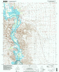
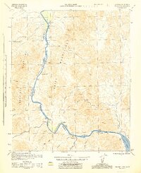
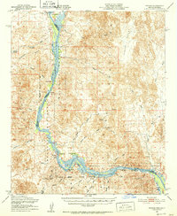
1997 Map of Imperial Reservoir
USGS Topo · Published 2003About this map
The Imperial Reservoir and the Imperial Dam Spillway 181 anchor this landscape along the border of California and Arizona. The map illustrates a complex water management system where the Colorado River feeds the Gila Main Canal and the Desilting Basin, critical for the region's agricultural and civil development. While much of the riverbank is preserved within the Imperial National Wildlife Refuge, evidence of historical human activity remains visible through the Old Senator Mine and the Castle Dome Landing (Site). The eastern portion of the quadrangle is dominated by the Yuma Test Station and its Military Reservation Boundary, showing a sharp contrast between the managed waterways and the arid desert terrain of the Chocolate Mountains. Local points of interest include Fishers Landing and Martinez Lake, centers for river-based recreation and settlement.
Find a feature on this map
25 named features on this map. Tap any name to fly to it.
Don’t see what you’re looking for? This feature index may not catch every label — zoom into the map to look around manually.
Map Details
Editions of this 1997 Imperial Reservoir Map
This is the sole edition of this map. No revisions or reprints were ever made.
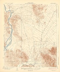
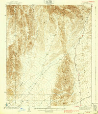
Other maps of this area

1903 · Yuma
USGS Topo · 1:125,000

1905 · Yuma
USGS Topo · 1:125,000
1929 · Laguna
USGS Topo · 1:62,500
1939 · Red Hill
USGS Topo · 1:62,500

1942 · Yuma
USGS Topo · 1:250,000

1942 · Blythe
USGS Topo · 1:250,000
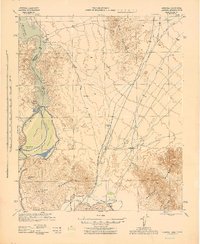
1943 · Laguna
USGS Topo · 1:62,500

1945 · Picacho Peak
USGS Topo · 1:62,500
1945 · Picacho
USGS Topo · 1:62,500
1951 · Picacho
USGS Topo · 1:62,500