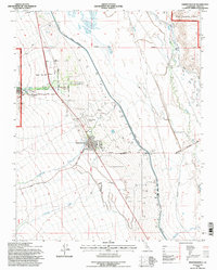
1994 Map of Independence
USGS Topo · Published 1997About this map
The high desert valley around Independence in the mid-1990s is defined by its complex relationship with water and historical land use. Dominating the landscape is the Los Angeles Aqueduct, which cuts a straight line through the valley floor, south of the Tulare Swamp. The town serves as a hub of civic and cultural life, containing both the Independence Cem and the nearby Fort Independence Indian Reservation, which includes an Indian Cem on Shabbell Lane.
Find a feature on this map
37 named features on this map. Tap any name to fly to it.
Don’t see what you’re looking for? This feature index may not catch every label — zoom into the map to look around manually.
Map Details
Editions of this 1994 Independence Map
This is the sole edition of this map. No revisions or reprints were ever made.
Other maps of this area

1907 · Mt. Whitney
USGS Topo · 1:125,000

1919 · Mt. Whitney
USGS Topo · 1:125,000

1937 · Mt. Whitney
USGS Topo · 1:125,000

1948 · Fresno
USGS Topo · 1:250,000

1951 · Independence
USGS Topo · 1:62,500

1953 · Mt. Pinchot
USGS Topo · 1:62,500

1955 · Fresno
USGS Topo · 1:250,000

1956 · Fresno
USGS Topo · 1:250,000

1956 · Mount Whitney
USGS Topo · 1:62,500

1958 · Fresno
USGS Topo · 1:250,000