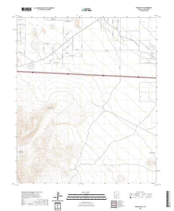
2021 Map of Indian Butte
USGS Topo · Published 2021About this map
Indian Butte rises as a prominent landmark in this Pinal County landscape, situated where the high desert terrain of the Table Top Mountains meets an expanding network of rural roads and agricultural development. The northern portion of the map shows a transitioning landscape, where traditional desert floor is bisected by the modern S John Wayne Pkwy and a grid of access roads including S Amarillo Valley Rd and S Herrera Rd. This 2021 survey documents the intersection of natural geologic features like Needle Peak with modern agricultural interests such as the Jojoba Fields. The presence of Canal Rd suggests the critical role of water management in sustaining these desert developments, while the southern reaches remain dominated by the contours of the high peaks.
Find a feature on this map
45 named features on this map. Tap any name to fly to it.
Don’t see what you’re looking for? This feature index may not catch every label — zoom into the map to look around manually.
Map Details
Editions of this 2021 Indian Butte Map
This is the sole edition of this map. No revisions or reprints were ever made.
Other maps of this area

1922 · Casa Grande
USGS Topo · 1:62,500

1924 · Casa Grande
USGS Topo · 1:62,500

1941 · Vekol Mountains
USGS Topo · 1:62,500

1942 · Silver Reef Mountains
USGS Topo · 1:62,500

1942 · Vekol Mountains
USGS Topo · 1:62,500

1946 · Antelope Peak
USGS Topo · 1:62,500

1948 · Antelope Peak
USGS Topo · 1:62,500

1953 · Ajo
USGS Topo · 1:250,000

1956 · Tucson
USGS Topo · 1:250,000

1957 · Ajo
USGS Topo · 1:250,000