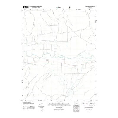
2011 Map of Indian Head
USGS Topo · Published 2011About this map
The Rio Grande flows through the center of this landscape, anchoring a network of water rights and mountain drainages just south of the San Luis Valley. The settlement of Hanna sits at a central crossroads, surrounded by an extensive grid of local routes including County Rd 15 and County Rd 71. This region is defined by its transition from valley floor to the foothills, where features like English Valley and Pronghorn Hl rise above the river plain. Significant irrigation and water management are evident through the presence of the Minor Ditch, while the southern reaches of the quadrangle are marked by the convergent flows of Pinos Creek and the East Branch Pinos Creek. In the northeast, the eponymous Indian Head landform overlooks the winding path of Old Woman Creek.
Find a feature on this map
23 named features on this map. Tap any name to fly to it.
Don’t see what you’re looking for? This feature index may not catch every label — zoom into the map to look around manually.
Map Details
Editions of this 2011 Indian Head Map
This is the sole edition of this map. No revisions or reprints were ever made.
Other maps of this area

1914 · Creede
USGS Topo · 1:125,000

1915 · Del Norte
USGS Topo · 1:125,000

1916 · Creede
USGS Topo · 1:125,000

1917 · Del Norte
USGS Topo · 1:125,000

1945 · Durango
USGS Topo · 1:250,000

1953 · Durango
USGS Topo · 1:250,000

1954 · Durango
USGS Topo · 1:250,000

1961 · Durango
USGS Topo · 1:250,000

1963 · Durango
USGS Topo · 1:250,000

1966 · Durango
USGS Topo · 1:250,000