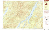
1997 Map of Indian Lake
USGS Topo · Published 1999About this map
Sabael sits on the western shore of Indian Lake, serving as a primary settlement point within this stretch of the Adirondack Park. The landscape is dominated by high peaks and water systems, including the prominent Snowy Mountain and the winding Cedar River Flow. Recreational infrastructure is evident through the Indian Lake Islands State Campground, which utilizes various landforms such as Kirpens Island and Moose Island.
Find a feature on this map
68 named features on this map. Tap any name to fly to it.
Don’t see what you’re looking for? This feature index may not catch every label — zoom into the map to look around manually.
Map Details
Editions of this 1997 Indian Lake Map
This is the sole edition of this map. No revisions or reprints were ever made.
Other maps of this area

1898 · Newcomb
USGS Topo · 1:62,500

1898 · Thirteenth Lake
USGS Topo · 1:62,500

1899 · Indian Lake
USGS Topo · 1:62,500

1900 · Canada Lake
USGS Topo · 1:62,500

1901 · Newcomb
USGS Topo · 1:62,500

1902 · Indian Lake
USGS Topo · 1:62,500

1903 · West Canada Lakes
USGS Topo · 1:62,500

1903 · Raquette Lake
USGS Topo · 1:62,500

1903 · Blue Mountain
USGS Topo · 1:62,500

1950 · Utica
USGS Topo · 1:250,000