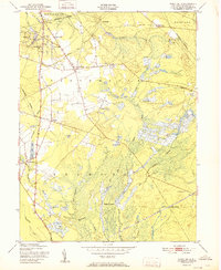
1951 Map of Indian Mills
USGS Topo · Published 1951About this map
Cranberry Bogs and intricate water systems dominate this mid-century landscape in Burlington County, reflecting the specialized agriculture of the New Jersey Pine Barrens. The map reveals a transition from historic industrial sites like Hampton Furnace to established settlements such as Indian Mills and Tabernacle. Waterways like Bread and Cheese Run and the Batsto River wind through the township boundaries of Shamong and Southampton, feeding into Indian Mills Lake. Evidence of the region's transport and milling history is clear, with the Central Railroad of New Jersey cutting through the southern reach near High Crossing, while former mill sites like Moores Mill indicate the earlier economic drivers of the area. This survey captures a specific moment when rural post-war development began to interface with the traditional bog-iron and berry-growing landscapes of the Pinelands.
Find a feature on this map
36 named features on this map. Tap any name to fly to it.
Don’t see what you’re looking for? This feature index may not catch every label — zoom into the map to look around manually.
Map Details
Editions of this 1951 Indian Mills Map
2 editions found
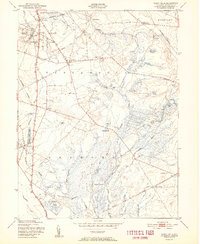
Other maps of this area

1888 · Pemberton
USGS Topo · 1:62,500

1888 · Mount Holly
USGS Topo · 1:62,500

1890 · Hammonton
USGS Topo · 1:62,500

1890 · Mullica
USGS Topo · 1:62,500

1894 · Hammonton
USGS Topo · 1:62,500

1894 · Pemberton
USGS Topo · 1:62,500

1894 · Mount Holly
USGS Topo · 1:62,500

1894 · Mullica
USGS Topo · 1:62,500

1898 · Pemberton
USGS Topo · 1:62,500

1898 · Mount Holly
USGS Topo · 1:62,500
Featured Places
- Southampton Township, NJ
- Tabernacle Township, NJ
- Shamong Township, NJ
- Meadford Farms, Tabernacle Township
- Oriental, Tabernacle Township