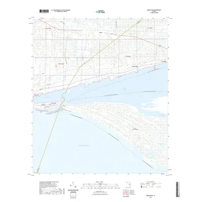
2021 Map of Indian Pass
USGS Topo · Published 2021About this map
Saint Vincent Island dominates the southeastern quadrant of this coastal survey, separated from the mainland by the waters of Saint Vincent Sound and the narrow opening at Indian Pass. This maritime landscape is defined by the complex transition from the mainland settlements of Odena, Eleven Mile, and Nine Mile to the tidal marshes and lagoons that fringe the Gulf. The Indian Peninsula reaches toward the island, creating the sheltered Indian Lagoon, a geography that has long dictated local transport and fishing patterns in Gulf County.
Find a feature on this map
28 named features on this map. Tap any name to fly to it.
Don’t see what you’re looking for? This feature index may not catch every label — zoom into the map to look around manually.
Map Details
Editions of this 2021 Indian Pass Map
This is the sole edition of this map. No revisions or reprints were ever made.
Other maps of this area

1943 · Port St. Joe
USGS Topo · 1:31,680

1943 · Cape San Blas
USGS Topo · 1:31,680

1943 · West Pass
USGS Topo · 1:31,680

1943 · Indian Pass
USGS Topo · 1:24,000

1943 · Jackson River
USGS Topo · 1:24,000

1945 · Cape St. George
USGS Topo · 1:31,680

1945 · Lake Wimico
USGS Topo · 1:31,680

1945 · Jackson River
USGS Topo · 1:31,680

1945 · Indian Pass
USGS Topo · 1:31,680

1949 · Apalachicola
USGS Topo · 1:250,000