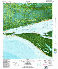
1982 Map of Indian Pass
USGS Topo · Published 1983About this map
St Vincent Island dominates this coastal survey, serving as the centerpiece of the St Vincent National Wildlife Refuge. The map provides an intricate look at the dynamic shoreline where the Gulf of Mexico meets the St Vincent Sound. A striking series of beach ridges and swales characterizes the island's topography, indicating its geological evolution over centuries. To the north across the sound, the mainland is defined by the Forbes Purchase Line, a historic boundary demarcating the vast land grant that shaped settlement in this part of Florida.
Find a feature on this map
26 named features on this map. Tap any name to fly to it.
Don’t see what you’re looking for? This feature index may not catch every label — zoom into the map to look around manually.
Map Details
Editions of this 1982 Indian Pass Map
This is the sole edition of this map. No revisions or reprints were ever made.
Other maps of this area

1943 · Port St. Joe
USGS Topo · 1:31,680

1943 · Cape San Blas
USGS Topo · 1:31,680

1943 · West Pass
USGS Topo · 1:31,680

1943 · Indian Pass
USGS Topo · 1:24,000

1943 · Jackson River
USGS Topo · 1:24,000

1945 · Cape St. George
USGS Topo · 1:31,680

1945 · Lake Wimico
USGS Topo · 1:31,680

1945 · Jackson River
USGS Topo · 1:31,680

1945 · Indian Pass
USGS Topo · 1:31,680

1949 · Apalachicola
USGS Topo · 1:250,000