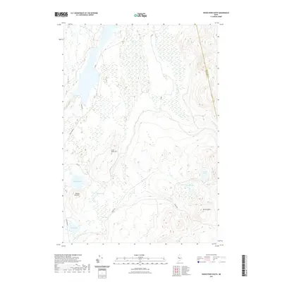
2021 Map of Indian Pond South
USGS Topo · Published 2021About this map
Indian Pond and its surrounding wetlands dominate this 2021 landscape in the Maine woods, where the boundary between Somerset Co and Piscataquis Co follows the high ground. The area is defined by a complex network of water and terrain, ranging from the low-lying Little Indian Bog and Scribner Bog to the elevations of Little Indian Hill and Knights Pond Hill. A series of isolated water bodies, including Frypan Pond and Round Pond, are connected by seasonal drainages like Indian Stream and Alder Stream. This is a working forest environment, evidenced by the network of unpaved access routes such as Indian Pond Rd, Brocha Rd, and VIP Rd, which navigate the bogs and ridges of this North Woods interior.
Find a feature on this map
20 named features on this map. Tap any name to fly to it.
Don’t see what you’re looking for? This feature index may not catch every label — zoom into the map to look around manually.
Map Details
Editions of this 2021 Indian Pond South Map
This is the sole edition of this map. No revisions or reprints were ever made.
Other maps of this area

1905 · The Forks
USGS Topo · 1:62,500

1907 · The Forks
USGS Topo · 1:62,500

1920 · Moosehead Lake
USGS Topo · 1:62,500

1921 · Brassua Lake
USGS Topo · 1:62,500

1922 · Moosehead Lake
USGS Topo · 1:62,500

1923 · Brassua Lake
USGS Topo · 1:62,500

1930 · Moosehead Lake
USGS Topo · 1:62,500

1944 · Brassua Lake
USGS Topo · 1:62,500

1944 · Moosehead Lake
USGS Topo · 1:62,500

1951 · Greenville
USGS Topo · 1:62,500
Featured Places
- Chase Stream Township, ME
- East Moxie Township, ME
- Moosehead Junction Township, ME
- Moxie Gore, ME
- Indian Stream Township, ME