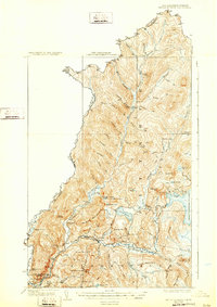
1927 Map of Indian Stream
USGS Topo · Published 1932About this map
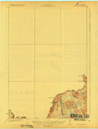
Pittsburg and the northernmost reaches of the Connecticut River define this frontier landscape during the mid-1920s. This survey by D.H. Watson and S.E. Clement highlights a region dominated by logging and backcountry outpost life, where numerous timber camps like Greeley Camp and Holden Camp sit tucked into the valleys of Indian Stream and its many branches. The settlement pattern follows the waterways, with the Maine Central rail line skirting the southwestern edge near Beecher Falls.
Find a feature on this map
62 named features on this map. Tap any name to fly to it.
Don’t see what you’re looking for? This feature index may not catch every label — zoom into the map to look around manually.
Map Details
Editions of this 1927 Indian Stream Map
5 editions found
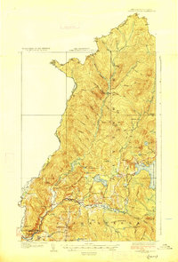
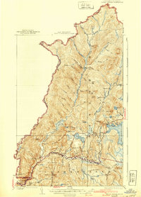

Other maps of this area

1925 · Indian Stream
USGS Topo · 1:48,000

1926 · Indian Stream
USGS Topo · 1:62,500

1927 · Indian Stream
USGS Topo · 1:62,500
1927 · Moose Bog
USGS Topo · 1:48,000

1927 · Second Lake
USGS Topo · 1:62,500

1929 · Averill
USGS Topo · 1:62,500

1930 · Dixville
USGS Topo · 1:62,500

1930 · Errol
USGS Topo · 1:62,500
1931 · Moose Bog
USGS Topo · 1:62,500

1932 · Second Lake
USGS Topo · 1:62,500