
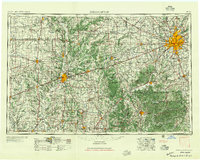
1957 Map of Indianapolis
USGS Topo · Published 1957About this map
The radiating rail lines of the Pennsylvania, New York Central, and Monon railroads define the mid-century landscape of Central Indiana. At the heart of the sheet, Indianapolis serves as a massive transit hub, with the enclave of Speedway and the industrial suburb of Beech Grove visible on its periphery. To the south and west, the map documents the transition from the flat glacial plains to the dissected topography of the White River valley and the high ridges of Brown County State Park.
Find a feature on this map
288 named features on this map. Tap any name to fly to it.
Don’t see what you’re looking for? This feature index may not catch every label — zoom into the map to look around manually.
Map Details
Editions of this 1957 Indianapolis Map
2 editions found
Other maps of this area

1899 · Danville
USGS Topo · 1:62,500

1900 · Danville
USGS Topo · 1:62,500

1906 · Urbana
USGS Topo · 1:62,500

1908 · Clay City
USGS Topo · 1:48,000

1908 · Bloomington
USGS Topo · 1:48,000

1908 · Bloomfield
USGS Topo · 1:62,500

1910 · Clay City
USGS Topo · 1:62,500

1910 · Hardinville
USGS Topo · 1:62,500

1910 · Bloomington
USGS Topo · 1:62,500

1917 · Birds
USGS Topo · 1:62,500