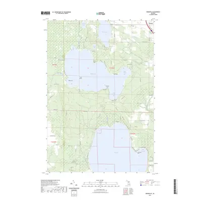
2023 Map of Indianville
USGS Topo · Published 2023About this map
Douglas Lake and Burt Lake dominate this Northern Michigan landscape, separated by the low-lying wetlands of Reeses Swamp. The shoreline of Douglas Lake is marked by prominent landforms such as Bently Point, Maple Point, and Sedge Point, while its waters are divided into distinct sections like Marl Bay and North Fishtail Bay. The geography suggests a long history of seasonal habitation and water-based transit, particularly near the East Branch Maple River and Silver Strand Beach.
Find a feature on this map
79 named features on this map. Tap any name to fly to it.
Don’t see what you’re looking for? This feature index may not catch every label — zoom into the map to look around manually.
Map Details
Editions of this 2023 Indianville Map
This is the sole edition of this map. No revisions or reprints were ever made.
Other maps of this area

1955 · Cheboygan
USGS Topo · 1:250,000

1957 · Wolverine
USGS Topo · 1:62,500

1957 · Mullett Lake
USGS Topo · 1:62,500

1958 · Cheboygan
USGS Topo · 1:250,000

1958 · Pellston
USGS Topo · 1:62,500

1958 · Petoskey
USGS Topo · 1:62,500

1975 · Petoskey NE
USGS Topo · 1:24,000

1982 · Petoskey
USGS Topo · 1:100,000
1982 · Levering
USGS Topo · 1:25,000

1982 · Pellston
USGS Topo · 1:25,000