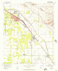
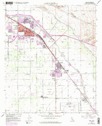
1956 Map of Indio
USGS Topo · Published 1957About this map
Agricultural development and water management define the landscape around Indio and Coachella during the mid-1950s. The intricate network of the Coachella Canal, the Whitewater Stormwater River Channel, and various wasteways illustrates the engineering required to sustain this desert valley. The map details a growing community, showing several local institutions such as Andrew Jackson School, Herbert Hoover School, and the Coachella Valley Union High School.
Find a feature on this map
36 named features on this map. Tap any name to fly to it.
Don’t see what you’re looking for? This feature index may not catch every label — zoom into the map to look around manually.
Map Details
Editions of this 1956 Indio Map
5 editions found
Other maps of this area

1904 · Indio
USGS Topo · 1:125,000

1941 · Toro Peak
USGS Topo · 1:62,500

1941 · Coachella
USGS Topo · 1:62,500

1941 · Edom
USGS Topo · 1:62,500

1943 · Coachella
USGS Topo · 1:62,500

1944 · Toro peak
USGS Topo · 1:62,500

1944 · Edom
USGS Topo · 1:62,500

1944 · Pinyon Well
USGS Topo · 1:62,500

1947 · Santa Ana
USGS Topo · 1:250,000

1949 · Santa Ana
USGS Topo · 1:250,000