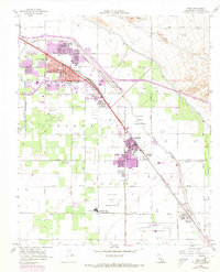
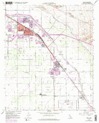
1956 Map of Indio
USGS Topo · Published 1973About this map
The Coachella Valley landscape in the mid-1950s is defined by a sophisticated water management system and expanding agricultural and civic infrastructure. The Coachella Canal and Whitewater River are joined by an intricate network of drainage and storm channels like Storm Water Channel and Wasteway No 3, enabling the growth of Indio, Coachella, and Thermal. This survey highlights the local prominence of education and public services, featuring numerous campuses from the Andrew Jackson School to the Coachella Valley Union High School. The intersection of traditional tribal lands at the Cabezon Indian Reservation and Augustine Indian Reservation with commercial assets like the Southern Pacific railroad and the County Fairground reflects a region in transition. The presence of the USDA Farm further underscores the area's specialized desert agricultural economy during this era.
Find a feature on this map
35 named features on this map. Tap any name to fly to it.
Don’t see what you’re looking for? This feature index may not catch every label — zoom into the map to look around manually.
Map Details
Editions of this 1956 Indio Map
5 editions found
Other maps of this area

1904 · Indio
USGS Topo · 1:125,000

1941 · Toro Peak
USGS Topo · 1:62,500

1941 · Coachella
USGS Topo · 1:62,500

1941 · Edom
USGS Topo · 1:62,500

1943 · Coachella
USGS Topo · 1:62,500

1944 · Toro peak
USGS Topo · 1:62,500

1944 · Edom
USGS Topo · 1:62,500

1944 · Pinyon Well
USGS Topo · 1:62,500

1947 · Santa Ana
USGS Topo · 1:250,000

1949 · Santa Ana
USGS Topo · 1:250,000