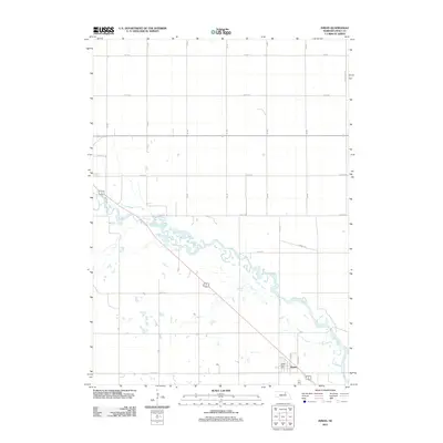
2011 Map of Inman
USGS Topo · Published 2011About this map
Inman serves as the primary settlement on this Nebraska landscape, situated near the southern edge of the quadrangle. The community's local infrastructure is anchored by the Inman Post Office and a grid of streets including Main St. The town sits just south of the meandering Elkhorn River, which winds across the central portion of the map in a complex network of channels and wetlands. This waterway, combined with the presence of the Cowboy Trl—a significant recreational path following a former railroad corridor—reflects the transition from a rail-based transport economy to one defined by conservation and recreation. The surrounding terrain is organized by a precise section-line road network, featuring routes such as 871st Rd and 874 Rd, which facilitate the agricultural operations that dominate this section of Holt County.
Find a feature on this map
15 named features on this map. Tap any name to fly to it.
Don’t see what you’re looking for? This feature index may not catch every label — zoom into the map to look around manually.
Map Details
Editions of this 2011 Inman Map
This is the sole edition of this map. No revisions or reprints were ever made.
Other maps of this area

1954 · Dorsey SW
USGS Topo · 1:24,000

1954 · Opportunity
USGS Topo · 1:24,000

1954 · Meek SW
USGS Topo · 1:24,000

1955 · O'Neill
USGS Topo · 1:250,000

1958 · O'Neill
USGS Topo · 1:24,000

1958 · Inman
USGS Topo · 1:24,000

1958 · Page
USGS Topo · 1:24,000

1959 · O'Neill
USGS Topo · 1:250,000

1963 · Ewing SW
USGS Topo · 1:24,000

1964 · O'Neill SE
USGS Topo · 1:24,000