
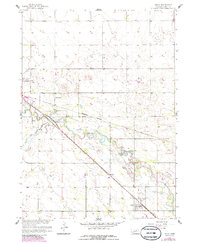
1958 Map of Inman
USGS Topo · Published 1959About this map
The Elkhorn River meanders across this Holt County landscape, creating a complex network of oxbows and marshy lowlands south of Inman. During the late 1950s, this area served as a significant transportation junction where the Chicago Burlington and Quincy and the Chicago and North Western railroads intersected near the town site. The presence of multiple rural schoolhouses, including School No 5, School No 17, and School No 24, illustrates the distributed nature of the agricultural community during this era. While the southern portion is dominated by the river's floodplain, the northern sections transition into the upland territories of Grattan and Antelope. Small-scale industrial activity is evident near the western edge at the Gravel Pits, while modern communication infrastructure appears via a Radio Tower and TV Tower.
Find a feature on this map
18 named features on this map. Tap any name to fly to it.
Don’t see what you’re looking for? This feature index may not catch every label — zoom into the map to look around manually.
Map Details
Editions of this 1958 Inman Map
2 editions found
Other maps of this area

1954 · Dorsey SW
USGS Topo · 1:24,000

1954 · Opportunity
USGS Topo · 1:24,000

1954 · Meek SW
USGS Topo · 1:24,000

1955 · O'Neill
USGS Topo · 1:250,000

1958 · O'Neill
USGS Topo · 1:24,000

1958 · Page
USGS Topo · 1:24,000

1959 · O'Neill
USGS Topo · 1:250,000

1963 · Ewing SW
USGS Topo · 1:24,000

1964 · O'Neill SE
USGS Topo · 1:24,000

1964 · O'Neill SW
USGS Topo · 1:24,000