
1958 Map of Page
USGS Topo · Published 1959About this map
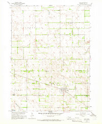
Page sits as a central hub in this late 1950s survey of Holt County, Nebraska. The town is physically defined by the Chicago Burlington and Quincy railroad, which cuts a sharp diagonal line across the prairie through the Verdigris township. This landscape reveals a high concentration of rural education hubs, including School No 128 and School No 23, though the presence of School No 138 (Abandoned) suggests the beginning of a consolidation era that would eventually change the rural Nebraska landscape. The terrain transitions from the water-rich areas near the Chain Lakes and Verdigre Creek to the more uniform agricultural grids of the Antelope and Iowa townships. Small-scale industrial activity is evident at a local Gravel Pit, supporting the development of the region's transport network.
Find a feature on this map
14 named features on this map. Tap any name to fly to it.
Don’t see what you’re looking for? This feature index may not catch every label — zoom into the map to look around manually.
Map Details
Editions of this 1958 Page Map
4 editions found
Other maps of this area

1954 · Dorsey SW
USGS Topo · 1:24,000

1954 · Opportunity
USGS Topo · 1:24,000

1954 · Star
USGS Topo · 1:24,000

1955 · O'Neill
USGS Topo · 1:250,000

1958 · Inman
USGS Topo · 1:24,000

1959 · O'Neill
USGS Topo · 1:250,000

1963 · Ewing SW
USGS Topo · 1:24,000

1963 · Venus
USGS Topo · 1:24,000

1963 · Ewing
USGS Topo · 1:24,000

1964 · O'Neill SE
USGS Topo · 1:24,000