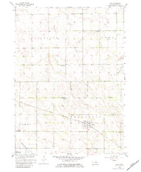
1958 Map of Page
USGS Topo · Published 1984About this map
Page serves as the central hub for this portion of Nebraska, situated along the Chicago Burlington and Quincy railroad line. The map reveals a rural landscape dominated by township boundaries and a system of numbered country schoolhouses, such as School No 128 and School No 57, which underscore the localized nature of the mid-century education system. An interesting detail is the labeling of School No 138 (Abandoned), documenting a specific moment of consolidation or shift in the rural community.
Find a feature on this map
15 named features on this map. Tap any name to fly to it.
Don’t see what you’re looking for? This feature index may not catch every label — zoom into the map to look around manually.
Map Details
Editions of this 1958 Page Map
4 editions found
Other maps of this area

1954 · Dorsey SW
USGS Topo · 1:24,000

1954 · Opportunity
USGS Topo · 1:24,000

1954 · Star
USGS Topo · 1:24,000

1955 · O'Neill
USGS Topo · 1:250,000

1958 · Inman
USGS Topo · 1:24,000

1958 · Page
USGS Topo · 1:24,000

1959 · O'Neill
USGS Topo · 1:250,000

1963 · Ewing SW
USGS Topo · 1:24,000

1963 · Venus
USGS Topo · 1:24,000

1963 · Ewing
USGS Topo · 1:24,000