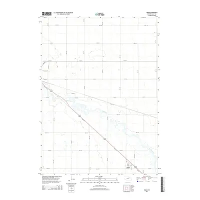
2014 Map of Inman
USGS Topo · Published 2014About this map
The Inman townsite serves as the primary focal point of this Holt County landscape, situated along a transportation corridor that follows the diagonal course of the Elkhorn River. This waterway and its tributary, Dry Cr, dictate the drainage patterns across a grid of section roads. A significant modern feature is the Cowboy Trl, a long-distance recreational path that follows the old railroad right-of-way through the heart of the settlement. The map documents the persistent rural character of the region, where the street names within Inman, such as Main St and Section St, transition abruptly into a expansive network of rural avenues and roads like Settlers Rd and Pioneer Rd. This survey provides a precise record of the land division and hydraulic features in this portion of northern Nebraska.
Find a feature on this map
29 named features on this map. Tap any name to fly to it.
Don’t see what you’re looking for? This feature index may not catch every label — zoom into the map to look around manually.
Map Details
Editions of this 2014 Inman Map
This is the sole edition of this map. No revisions or reprints were ever made.
Other maps of this area

1954 · Dorsey SW
USGS Topo · 1:24,000

1954 · Opportunity
USGS Topo · 1:24,000

1954 · Meek SW
USGS Topo · 1:24,000

1955 · O'Neill
USGS Topo · 1:250,000

1958 · O'Neill
USGS Topo · 1:24,000

1958 · Inman
USGS Topo · 1:24,000

1958 · Page
USGS Topo · 1:24,000

1959 · O'Neill
USGS Topo · 1:250,000

1963 · Ewing SW
USGS Topo · 1:24,000

1964 · O'Neill SE
USGS Topo · 1:24,000