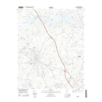
2014 Map of Inman
USGS Topo · Published 2014About this map
The industrial and residential growth of northern Spartanburg County centers on the longstanding textile community of Inman Mills and the neighboring city of Inman. This 2014 survey illustrates the modern expansion of these settlements alongside the major transportation corridor of the Asheville Hwy. To the north, the landscape is defined by the reservoir waters of Lake William C Bowen, where the Campton Bridge crosses the upper reaches of the S Pacolet River. The map shows a transition from suburban neighborhoods like Highland Park and Woodridge to the more open terrain near Gramling. Numerous private ponds such as Milliken Lake and W W Wilkins Pond are scattered across the drainage basins of Greene Cr and Lawsons Fork Cr, indicating the localized water management common to this Piedmont region.
Find a feature on this map
33 named features on this map. Tap any name to fly to it.
Don’t see what you’re looking for? This feature index may not catch every label — zoom into the map to look around manually.
Map Details
Editions of this 2014 Inman Map
This is the sole edition of this map. No revisions or reprints were ever made.
Other maps of this area

1907 · Saluda
USGS Topo · 1:125,000

1935 · Greer
USGS Topo · 1:48,000

1938 · Greer
USGS Topo · 1:62,500

1941 · Spartanburg
USGS Topo · 1:250,000

1947 · Spartanburg
USGS Topo · 1:62,500

1949 · Spartanburg
USGS Topo · 1:24,000

1949 · Spartanburg
USGS Topo · 1:62,500

1953 · Spartanburg
USGS Topo · 1:250,000

1953 · Charlotte
USGS Topo · 1:250,000

1954 · Charlotte
USGS Topo · 1:250,000