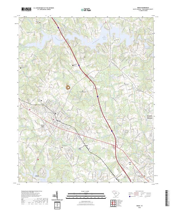
2024 Map of Inman
USGS Topo · Published 2024About this map
The South Pacolet River and its major impoundment, Lake William C Bowen, anchor the northern landscape of Spartanburg County in this modern topographic study. The city of Inman serves as the central hub, joined by the industrial footprint of Inman Mills and the nearby community of Campton. For genealogists, the map is remarkably dense with burial grounds, ranging from the Mount Zion Baptist Church of Gramling Graveyard to the First Baptist Church North Spartanburg Graveyard.
Find a feature on this map
273 named features on this map. Tap any name to fly to it.
Don’t see what you’re looking for? This feature index may not catch every label — zoom into the map to look around manually.
Map Details
Editions of this 2024 Inman Map
This is the sole edition of this map. No revisions or reprints were ever made.
Other maps of this area

1907 · Saluda
USGS Topo · 1:125,000

1935 · Greer
USGS Topo · 1:48,000

1938 · Greer
USGS Topo · 1:62,500

1941 · Spartanburg
USGS Topo · 1:250,000

1947 · Spartanburg
USGS Topo · 1:62,500

1949 · Spartanburg
USGS Topo · 1:24,000

1949 · Spartanburg
USGS Topo · 1:62,500

1953 · Spartanburg
USGS Topo · 1:250,000

1953 · Charlotte
USGS Topo · 1:250,000

1954 · Charlotte
USGS Topo · 1:250,000