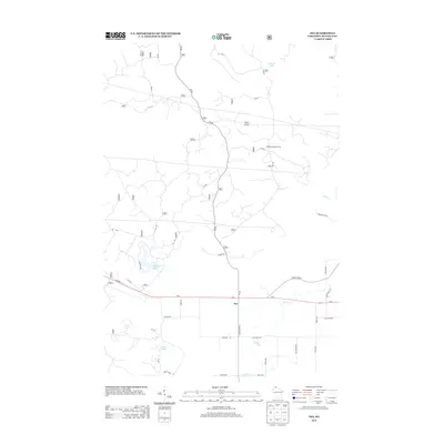
2013 Map of Ino
USGS Topo · Published 2013About this map
The small settlement of Ino serves as a central point in this part of Bayfield County, positioned along the busy corridor of Us-2. The landscape is defined by a dense network of forest roads and glacial water bodies, including Summit Lake to the north and the cluster of Spider Lake and Boris Lake to the west. This 2013 survey illustrates a region where local transit relies on a transition from highway travel to more isolated routes like County Hwy-E and Gazdik Ln. One of the most prominent landmarks in the northern section is the Moquah Lookout Tower, situated at a high elevation overlooking the surrounding timberlands and the headwaters of Pine Cr. Throughout the southern area, family-named roads such as Haviar Rd, Susienka Rd, and Kallgren Rd suggest the enduring presence of local homesteads and agricultural tracts along the winding course of N Fish Cr.
Find a feature on this map
42 named features on this map. Tap any name to fly to it.
Don’t see what you’re looking for? This feature index may not catch every label — zoom into the map to look around manually.
Map Details
Editions of this 2013 Ino Map
This is the sole edition of this map. No revisions or reprints were ever made.
Other maps of this area

1943 · Iron Lake
USGS Topo · 1:48,000

1944 · Moquah
USGS Topo · 1:48,000

1944 · Drummond
USGS Topo · 1:48,000

1944 · Grandview
USGS Topo · 1:48,000

1947 · Drummond
USGS Topo · 1:48,000

1947 · Moquah
USGS Topo · 1:48,000

1947 · Iron Lake
USGS Topo · 1:48,000

1947 · Grandview
USGS Topo · 1:48,000

1953 · Ashland
USGS Topo · 1:250,000

1958 · Ashland
USGS Topo · 1:250,000