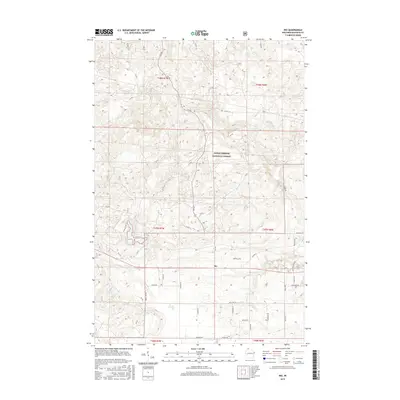
2015 Map of Ino
USGS Topo · Published 2015About this map
Ino sits at the junction of Co Hwy G and Highway 2, serving as a primary point of human settlement within the extensive wooded reaches of the Chequamegon National Forest. The landscape is defined by its complex glacial topography, where small water bodies like Spider Lake and Boris Lake are tucked into the drainages of N Fish Cr. The road network reveals a history of local land use and forestry, with numerous timber access routes such as FR 418 and FR 236 branching off from more established residential lanes. Family names are preserved in the local geography through thoroughfares like Hovanecz Rd, Haviar Rd, and Susienka Rd, while the southern portion of the quadrangle is dominated by the sprawling Ino Swamp. This survey provides a clear view of the interface between small northern Wisconsin communities and the surrounding managed forest lands.
Find a feature on this map
50 named features on this map. Tap any name to fly to it.
Don’t see what you’re looking for? This feature index may not catch every label — zoom into the map to look around manually.
Map Details
Editions of this 2015 Ino Map
This is the sole edition of this map. No revisions or reprints were ever made.
Other maps of this area

1943 · Iron Lake
USGS Topo · 1:48,000

1944 · Moquah
USGS Topo · 1:48,000

1944 · Drummond
USGS Topo · 1:48,000

1944 · Grandview
USGS Topo · 1:48,000

1947 · Drummond
USGS Topo · 1:48,000

1947 · Moquah
USGS Topo · 1:48,000

1947 · Iron Lake
USGS Topo · 1:48,000

1947 · Grandview
USGS Topo · 1:48,000

1953 · Ashland
USGS Topo · 1:250,000

1958 · Ashland
USGS Topo · 1:250,000