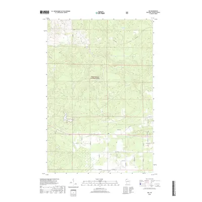
2018 Map of Ino
USGS Topo · Published 2018About this map
Chequamegon National Forest dominates this northern Wisconsin landscape, where the small settlement of Ino serves as a central point along the local road network. The terrain is defined by its extensive wetlands and water systems, most notably the large expanse of Ino Swamp and the waters of Bork Lake and Summit Lake. For the local historian or genealogist, the map preserves a detailed network of family-named roads, including Haviar Rd, Smarchik Rd, and Pristash Rd, which trace the property boundaries and settlement patterns of the area's residents. Drainage is managed by the winding courses of N Fish Cr and Pine Cr, while the Wolf Trail offers a route through the heavily wooded national forest lands.
Find a feature on this map
31 named features on this map. Tap any name to fly to it.
Don’t see what you’re looking for? This feature index may not catch every label — zoom into the map to look around manually.
Map Details
Editions of this 2018 Ino Map
This is the sole edition of this map. No revisions or reprints were ever made.
Other maps of this area

1943 · Iron Lake
USGS Topo · 1:48,000

1944 · Moquah
USGS Topo · 1:48,000

1944 · Drummond
USGS Topo · 1:48,000

1944 · Grandview
USGS Topo · 1:48,000

1947 · Drummond
USGS Topo · 1:48,000

1947 · Moquah
USGS Topo · 1:48,000

1947 · Iron Lake
USGS Topo · 1:48,000

1947 · Grandview
USGS Topo · 1:48,000

1953 · Ashland
USGS Topo · 1:250,000

1958 · Ashland
USGS Topo · 1:250,000