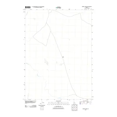
2010 Map of Inside Lakes
USGS Topo · Published 2010About this map
Inside Desert dominates this high-plateau region of Owyhee County, where the stark geography of Idaho's southern borderlands is defined by deep river canyons. The Jarbidge River meanders through the southern and western portions of the quadrangle, eventually meeting the Bruneau River which cuts across the northwest corner. This 2010 survey illustrates a landscape largely devoid of human infrastructure, focusing instead on the hydrological patterns of these significant drainage systems. The sparse labeling reflects the remote character of this high-desert environment, where the presence of water in the Jarbidge and Bruneau systems remains the primary navigational and ecological landmark for this corner of the state.
Find a feature on this map
3 named features on this map. Tap any name to fly to it.
Don’t see what you’re looking for? This feature index may not catch every label — zoom into the map to look around manually.
Map Details
Editions of this 2010 Inside Lakes Map
This is the sole edition of this map. No revisions or reprints were ever made.
Other maps of this area

1955 · Twin Falls
USGS Topo · 1:250,000

1958 · Twin Falls
USGS Topo · 1:250,000

1978 · The Arch
USGS Topo · 1:24,000

1979 · Stiff Tree Draw
USGS Topo · 1:24,000

1979 · Indian Hot Springs
USGS Topo · 1:24,000
1979 · Triguero Lake
USGS Topo · 1:24,000

1979 · Clover Butte South
USGS Topo · 1:24,000
1979 · Poison Butte
USGS Topo · 1:24,000

1979 · Cave Draw
USGS Topo · 1:24,000
1979 · Inside Lakes
USGS Topo · 1:24,000