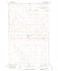
1972 Map of Inverness
USGS Topo · Published 1975About this map
The town of Inverness serves as the focal point of this agricultural landscape in north-central Montana during the early 1970s. Situated along the Burlington Northern railway, the settlement's infrastructure includes a Wt (water tower) and Substa, reflecting its role as a regional transport and utility hub. The survey area straddles the boundary between Liberty and Hill Counties, showing a high-plains terrain characterized by deep drainage systems like Hingham Coulee and the East Fork Black Coulee. Small-scale aviation and local genealogy are well-represented by the presence of Landing Strips and two burial sites, Cem and the County Cem, located south of the main rail line. The straight line of a Pipeline cutting through the southern half of the quadrangle highlights the industrial utility networks crossing the prairie during this era.
Find a feature on this map
14 named features on this map. Tap any name to fly to it.
Don’t see what you’re looking for? This feature index may not catch every label — zoom into the map to look around manually.
Map Details
Editions of this 1972 Inverness Map
This is the sole edition of this map. No revisions or reprints were ever made.
Other maps of this area

1919 · Alma
USGS Topo · 1:125,000

1954 · Shelby
USGS Topo · 1:250,000

1958 · Shelby
USGS Topo · 1:250,000

1963 · Joplin
USGS Topo · 1:24,000

1963 · Chester NE
USGS Topo · 1:24,000

1970 · Poverty Coulee NE
USGS Topo · 1:24,000

1970 · Rocky Coulee
USGS Topo · 1:24,000
1970 · Een School
USGS Topo · 1:24,000
1972 · Rudyard
USGS Topo · 1:24,000

1972 · Rudyard NW
USGS Topo · 1:24,000