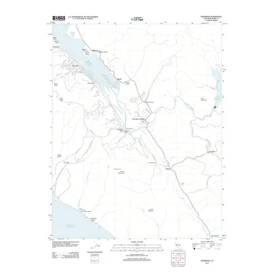
2012 Map of Inverness
USGS Topo · Published 2012About this map
Point Reyes National Seashore dominates the western portion of this coastal California landscape, where the ridges of Mount Vision and Mount Wittenberg drop toward the Pacific. The settlement of Inverness lines the shore of the inlet, while the interior is defined by the valley of Olema Cr and the historic crossroads at Olema. This coastal community shows a clear separation between the residential clusters of Seahaven and Inverness Park and the agricultural legacy preserved at Bear Valley Ranch and Laguna Ranch. Further east, the village of Point Reyes Station serves as a hub near where Lagunitas Cr meets the tide. Genealogists and local historians can find the Olema Cem located south of the main village, while hikers and researchers can trace trails through Divide Meadow and along the shores of Sculptured Beach.
Find a feature on this map
63 named features on this map. Tap any name to fly to it.
Don’t see what you’re looking for? This feature index may not catch every label — zoom into the map to look around manually.
Map Details
Editions of this 2012 Inverness Map
This is the sole edition of this map. No revisions or reprints were ever made.
Other maps of this area

1897 · Tamalpais
USGS Topo · 1:62,500

1914 · Petaluma
USGS Topo · 1:62,500

1916 · Point Reyes
USGS Topo · 1:48,000

1918 · Point Reyes
USGS Topo · 1:62,500

1941 · Tamalpais
USGS Topo · 1:62,500

1942 · Petaluma
USGS Topo · 1:62,500

1947 · Santa Rosa
USGS Topo · 1:250,000

1947 · San Francisco
USGS Topo · 1:250,000

1948 · San Francisco
USGS Topo · 1:250,000

1949 · Santa Rosa
USGS Topo · 1:250,000