2022 Map of Inverness
USGS Topo · Published 2022About this map
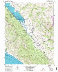
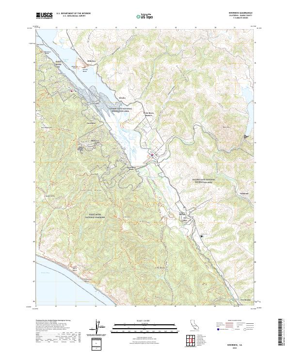
The Inverness Ridge serves as the structural spine of this Marin County landscape, dividing the waters of Tomales Bay from the Pacific-facing Point Reyes National Seashore. The settlement pattern follows the contours of the bay and the Olema Cr valley, where small communities like Point Reyes Station and Inverness Park are established. To the southeast, the Olema area reveals local history through the Olema Cem, situated near the significant drainage of Lagunitas Creek. The terrain transitions from the high point at Mt Wittenberg down through coastal canyons like Tomasini Canyon and Grand Canyon. This 2022 survey details a complex geography of public land management, where the Golden Gate National Recreation Area and various coastal trails, such as the Bayview Trl, define the modern land use.
Find a feature on this map
118 named features on this map. Tap any name to fly to it.
Don’t see what you’re looking for? This feature index may not catch every label — zoom into the map to look around manually.
Map Details
Editions of this 2022 Inverness Map
This is the sole edition of this map. No revisions or reprints were ever made.