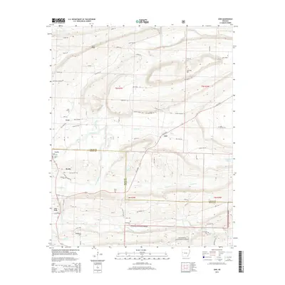
2014 Map of Ione
USGS Topo · Published 2014About this map
The Petit Jean River carves a central path through this terrain along the border of Logan and Scott Counties, where small agricultural settlements and remote homesteads characterize the rural landscape. The map highlights the community of Ione, situated along State Highway 23, alongside other established locales like Lucas and Boothe. This region is a focal point for genealogical research, documenting numerous family and community burial grounds including Bloodsworth Cemetery, Tomlinson Cemetery, and Little Cauthron Cemetery. To the south, the landscape transitions into the protected timberlands of the Ouachita National Forest, marked by elevation changes near Jennings Mountain and Sand Ridge. The network of local roads such as Dizzy Dean Road and Lucas Bottom Road provides a clear view of the area's development patterns and land use in the early 21st century.
Find a feature on this map
72 named features on this map. Tap any name to fly to it.
Don’t see what you’re looking for? This feature index may not catch every label — zoom into the map to look around manually.
Map Details
Editions of this 2014 Ione Map
This is the sole edition of this map. No revisions or reprints were ever made.
Other maps of this area

1879 · Poteau Mountain
USGS Topo · 1:62,500

1887 · Poteau Mountain #1
USGS Topo · 1:62,500

1887 · Mount Ida #2
USGS Topo · 1:62,500

1887 · Magazine Mountain #3
USGS Topo · 1:62,500

1887 · Magazine Mountain
USGS Topo · 1:62,500

1890 · Magazine Mountain
USGS Topo · 1:125,000

1890 · Mount Ida
USGS Topo · 1:125,000

1890 · Fort Smith
USGS Topo · 1:125,000

1890 · Poteau Mountain
USGS Topo · 1:125,000

1899 · Poteau Mountain
USGS Topo · 1:125,000