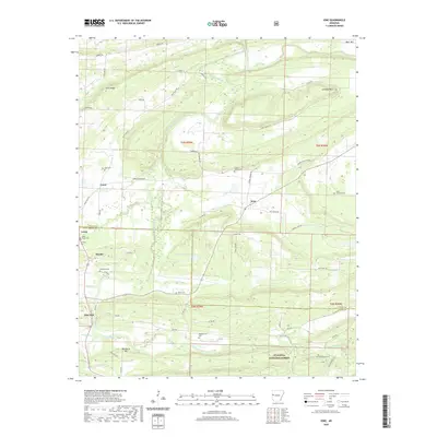
2020 Map of Ione
USGS Topo · Published 2020About this map
The Petit Jean River winds across this landscape, defining a rural corridor at the border of Logan and Scott Counties. Small settlements like Ione, Lucas, and Elm Park anchor the local road network, while the southern portion of the map transitions into the protected timberlands of the Ouachita National Forest. Numerous family-named burial grounds, such as Doss Cem, Bloodsworth Cem, and French Prairie Cem, are scattered throughout the hills, providing valuable data for genealogists tracking early regional families. The terrain is marked by significant rises including Sand Ridge, Jennings Mtn, and Blueberry Hill, which overlook smaller watercourses like Rock Creek and Prairie Br. This modern survey documents the ongoing rural character of the area, where gravel county roads and forest trails serve as the primary links between isolated farmsteads and the forested ridges of the interior.
Find a feature on this map
66 named features on this map. Tap any name to fly to it.
Don’t see what you’re looking for? This feature index may not catch every label — zoom into the map to look around manually.
Map Details
Editions of this 2020 Ione Map
This is the sole edition of this map. No revisions or reprints were ever made.
Other maps of this area

1879 · Poteau Mountain
USGS Topo · 1:62,500

1887 · Poteau Mountain #1
USGS Topo · 1:62,500

1887 · Mount Ida #2
USGS Topo · 1:62,500

1887 · Magazine Mountain #3
USGS Topo · 1:62,500

1887 · Magazine Mountain
USGS Topo · 1:62,500

1890 · Magazine Mountain
USGS Topo · 1:125,000

1890 · Mount Ida
USGS Topo · 1:125,000

1890 · Fort Smith
USGS Topo · 1:125,000

1890 · Poteau Mountain
USGS Topo · 1:125,000

1899 · Poteau Mountain
USGS Topo · 1:125,000