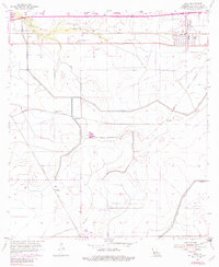
1955 Map of Iowa
USGS Topo · Published 1982About this map
The Southern Pacific and Missouri Pacific railroads define the industrial and transit corridor of this Calcasieu Parish landscape, converging near the established settlement of Iowa. The map reveals a transition from the agricultural and rail-oriented centers of Manchester and Chloe in the north to the expanding energy sector in the south, anchored by the Holmwood Oil and Gas Field and Bell City Gas Field. The terrain is characterized by a sophisticated water management system, including the Government Ditch and an extensive network of levee structures that protect the low-lying prairie around English Bayou. Notable local landmarks like the Southwest Louisiana Boys Village and the rural communities of Bellevue and Bon Air provide specific points of interest for genealogists and local historians tracking the mid-century development of the region before significant late-20th-century suburban expansion.
Find a feature on this map
25 named features on this map. Tap any name to fly to it.
Don’t see what you’re looking for? This feature index may not catch every label — zoom into the map to look around manually.
Map Details
Editions of this 1955 Iowa Map
3 editions found
Other maps of this area

1932 · Lake Charles NE
USGS Topo · 1:31,680

1932 · Lake Charles NW
USGS Topo · 1:31,680

1932 · Lake Charles SW
USGS Topo · 1:31,680

1932 · Lake Charles SE
USGS Topo · 1:31,680

1935 · Moss Bluff
USGS Topo · 1:31,680

1942 · Lake Charles
USGS Topo · 1:62,500

1946 · Lacassine
USGS Topo · 1:31,680

1946 · Hayes
USGS Topo · 1:31,680

1947 · Fenton
USGS Topo · 1:31,680

1947 · Moss Bluff
USGS Topo · 1:31,680